Khoa Công Nghệ Thông Tin

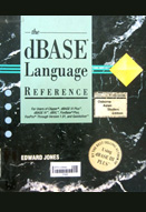
This helpful guide covers the differences between the popular dialects of the dBASE language, including dBASE III Plus and IV, FoxPro, and Clipper. Also includes command reference, featuring the syntax, use, and examples of each command.
- Vị trí lưu trữ: Tồn kho (03 Quang Trung)
- Tổng sách: 1
- Đang rỗi: 1

End-user training for sci-tech databases
Introduction; Teaching controlled vocabulary and natural language to end-users of scientific online and CD-ROM databases; End-user searching in the corporate research setting: a planning ...

Y2K : a system-wide checklist for your business Chapter 1:The Y2K problem; Chapter 2: Implication of Y2K for your business; Chapter 3: The Y2K project plan; Chapter 4: Fixing the infrastructure; Chapter 5: Fixing applications; Chapter 6: Test and migration; Chapter 7: Y2K resources

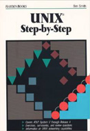
Introduction to UNIX, getting started, user interfaces, files, regular expression, special characters and wildcards,...

This book is destined to become the essential desktop/briefcase reference for busy SGML practitioners. Neil Bradley's philosophy, 'to get to the point quickly and stick with it until it's been fully explained', has been eagerly received by his reviewers: Features include: *a detailed study of the ...
|


