Khoa Công Nghệ Thông Tin

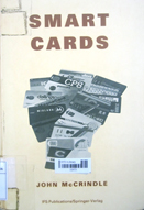
Smart cards are coming into widespread use around the world. They contain a microcomputer that can identify a person's identity through his (PIN) Personal Identification Number. It has a memory capable of storing transactions as well as carrying them out and can communicate with other devices such ...
- Vị trí lưu trữ: Tồn kho (03 Quang Trung)
- Tổng sách: 1
- Đang rỗi: 1

Information systems literacy: Paradox 3.5
This book presents the Paradox software package and is one component in a modular series of textbook developed for use in introductory computing course. The text is written for a first course in database design or for any course in which a database tutorial is ...
- Vị trí lưu trữ: Tồn kho (03 Quang Trung)
- Tổng sách: 1
- Đang rỗi: 1

The design of bibliographies : observations, references, and examples
This book discusses the basics of book typography and then goes on to describe types and formats of bibliographies. Berger presents brief discussions of the elements of design that bibliography compilers and designers must consider--drawing from many relevant sources to ...
- Vị trí lưu trữ: Tồn kho (03 Quang Trung)
- Tổng sách: 1
- Đang rỗi: 1

New perspectives on data-driven web sites with microsoft access 2000 : tools for e-commerce
The author has fully incorporated this approach in creating a holistic work which embodies the concepts of the Internet and the World Wide Web (yes, they are in fact completely different), tying into the literature screen shots and sequential series which polish the ...
- Vị trí lưu trữ: 03 Quang Trung
- Tổng sách: 1
- Đang rỗi: 1

Case*method : tasks and deliverables
This highly practical book identifies the key tasks and defines the major deliverables required at every stage of the development life cycle. Highlights of the book include: *clear checklists, estimating factors and quality controls for application system development *helpful guidelines for ...
- Vị trí lưu trữ: 03 Quang Trung
- Tổng sách: 1
- Đang rỗi: 1


