Geographic information systems
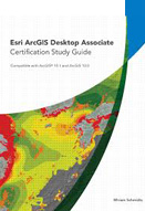
Esri ArcGIS desktop associate : certification study guide (with CD)
1. Understanding ArcGIS products and extensions; 2. Working with geographic data storage formats; 3. Using the geodatabase; 4. Managing geographic data; 5. Coordinate systems; 6. Evaluating data; 7. Associating tables; 8. Georeferencing and spatial adjustment; 9. Geocoding; 10. Creating feature ...
- Vị trí lưu trữ: 03 Quang Trung
- Tổng sách: 1
- Đang rỗi: 0
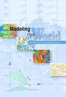
Modeling our World : the ESRI guide to geodatabase design
1. Object modeling and geodatabases; 2. How maps inform; 3. Gis data representations; 4. The structure of geographic data; 5. Smart features; 6. The shape of features; 7. Managing work flow with versions; 8. Linear modeling with networks; 9. Cell-based modeling with rasters; 10. Surface modeling ...
- Vị trí lưu trữ: 03 Quang Trung
- Tổng sách: 1
- Đang rỗi: 0
ArcGIS 9 : building a geodatabase
1. Introduction; 2. Creating new items in a geodatabase; 3. Importing data; 4. Topology; 5. Subtypes and attribute domains; 6. Defining relationship classes; 7. Geometric networks; 8. Managing annotation; 9. Dimensioning; 10. Working with a versioned geodatabase; 11. Disconnected editing; 12. ...
- Vị trí lưu trữ: 03 Quang Trung
- Tổng sách: 1
- Đang rỗi: 0
1. Seeing the scope of GIS; 2. Recognizing how maps show information; 3. Reading, analyzing and interpreting maps; 4. Creating a conceptual model; 5. Understanding the GIS data models; 6. Keeping track of data descriptions; 7. Managing multiple maps; 8. Gathering and digitizing geographic data; …
- Vị trí lưu trữ: 03 Quang Trung
- Tổng sách: 1
- Đang rỗi: 0
Mastering ArcGIS (with CD-ROM) : 5th ed.
1. Gis data; 2. Mapping Gis data; 3. Presenting Gis data; 4. Attribute data; 5. Queries; 6. Spatial joins; 7. Map overlay; 8. Raster analysis; 9. Network analysis; 10. Geocoding; 11. Coordinate systems; 12. Basic editing; 13. Editing and topology; 14. Geodatabases; 15. Metadata.
- Vị trí lưu trữ: 03 Quang Trung
- Tổng sách: 1
- Đang rỗi: 0


